The clipper drove on through and dropped about an inch. Amateur radio reports were mostly 1 inch this morning with 3 inches on the ground. It is warming up so the slight chance for precipitation for today will come as rain.
The warm up will come in over the weekend likely leaving just the man made snow piles by Sunday afternoon. Next week brings a storm that really has people excited. The NWS offices uses the phrase "slow and strong" to describe the system and tosses out "potential to produce heavy amounts of precipitation."
Now what does than mean? A lot of rain or a lot of snow or a mix. Snow does seem very possible with 4+ inches not all than unrealistic. It will take a couple of more day to get a real idea on what will be happening. Sunday evening will be my next detailed post on the upcoming storm.
In the mean time, enjoy the balmy weather and I will post a recap from the Severe Weather Symposium I am attending on Saturday.
Friday, February 29, 2008
As expected...

Thursday, February 28, 2008
Tonight's Snow & Next Weeks Confusion...
The clipper system tonight will be diving into our area pushing the snow ahead of it. The normal scenario is to have it come behind with the colder air. It is going to start as snow tonight but likely change to a mix to rain tomorrow morning. Some solutions show it remaining cold enough to stay all snow. Either solution will not have much moisture to work with so 1-2 inches will be all we should receive.
The morning drive to work or school could be another tricky mess. (I will spare you the lecture about driving for conditions.)
The weekend looks sunny and warm but some late Sunday precipitation keep creeping into the forecasts. That may drive down the expected high of 50 degrees.
The next big one...
The start of next week looks to be a wicked mess of weather. Models are flip-flopping almost with each run and doing it so wild I don't think anyone has a real handle right now. One of the major problems is the closed low pressure which is below the flow of the jet stream. Its path is very unpredictable. For us, we could see anything from warm with severe weather to a heavy rain storm of 2-3 inches to 6-12 inches of snow or a mix of everything. I think it is going to take some time to sort this one all out.
Wednesday, February 27, 2008
Our next clipper...
The clipper system coming in Thursday night and Friday will bring a couple of inches of snow. It looks colder on the models but the moisture isn't there to really produce a lot of snow. Some possible frozen precipitation is possible but doesn't seem likely.
A warm and what looks to be a dry weekend is ahead. Enjoy since next week looks to be a wicked mess. (The use of the word wicked is deliberate.)
Mid Day Update
The clipper event for Thursday night into Friday looks to start as snow dropping an inch or two before warm air turns in into rain. It should not be a problem except on road surfaces where drivers go too fast for conditions and end up sliding-off or causing an accident.
I know it sounds like a rant but the number of accidents I keep hearing on the police scanner is unbelievable. You can hear the frustration of the officers. Even when there are 2 or 3 slide-offs in a short stretch of road and a couple of officers on scene with their lights on, people continue to speed along and end up in the ditch. Slow down people, just slow down!
Back to the clipper system, the most recent model runs show it a little colder but I wouldn’t hold out hope for an all snow event. An all snow event would be 3-5 inches which seem unlikely.
Next week has a storm which looks like more rain for us than snow but it has shown some flip-flop on a few model runs so hope is there for a snow maker. Of course the snow maker solutions are so way overdone dropping 8-12 inches of the stuff which naturally makes is less likely to happen.
Next week is Severe Weather Preparedness Week. I will try to feature some severe weather information each day. You can find daily information from the NWS next week too. -CLICK HERE- Of course one very important thing is to have a severe weather radio for home and work. I will discuss those in more detail next week.
Tuesday, February 26, 2008
Very Poor Road Conditions Tonight
There are so many accidents the police are unable to respond to them all. On the east side of the county the are sliding off one right after another in front of the police. People are NOT slowing down and driving for conditions. Wake up people! You risk the lives of everyone with your reckless behavior.
My advice...
Stay off the roads!
Greasy Snow
That is the term to apply to the snow we just received. A typical snow ratio is 10-12 inches of snow for each inch of water (rain). The fluffy stuff can have ratios of 20 to 1. Lake effect can be 40 to 1 or higher.
The heavy wet snow we received has ratios of 2-4 to 1. Some people call this Greasy Snow. It can also be called Heart Attack Snow.
Imagine if we had fluffy snow overnight. A foot or more would have been on the ground today.
All but over...
The snow is all but stopped with some lingering flurries possible. The low pressure driving this system has moved over West Virginia and the NWS has dropped the advisory for our county and all counties south. The winds are picking up but I didn't see any real issues after taking a short drive in the county. The overnight/morning snow was very wet and heavy and isn't looking to blow around much.
Temperatures remain near the freezing mark and the roads look generally in good shape. A few scattered slick spots remain but driving with common sense should get you there fine. With that said, I hear of another accident on the scanner every few minutes. I guess some people don't get it.
For those keeping track of my snow day predictions, I predicted six. I currently have three. While I am not going to say uncle and give up yet, I do realize my opportunities are dwindling pretty quickly. There are several more storms on the long range models, most could end up with marginal temperatures and be hit or miss for our area. The daytime heating is starting to erode away the really cold temperature needed for snow.
I also want to commend the NWS office in Indianapolis. I might have sounded rather critical of their recent decisions regarding watches, warnings, and advisories and snow totals. In the end they did a much better job making the call than those of us that are weather weenies demanding our snow fantasies come true.
We (weenies) all believed the storm was coming south. It did moved south on the models the last 24 to 36 hours before the storm arrived and we convinced ourselves we were going to get a good dump. We were going to steal the snow from Wisconsin and Chicago which have record or near record snow totals. Unfortunately the southern track was not nearly as deep as we had hoped. While Milwaukee, Wisconsin busted on their early trigger for heavy snows and warnings, it didn’t translate into our miracle. Just above of our area the northern portions of Indiana did make out like snow bandits even before the lake effect kicked in. It just needed to come down another 75 to 100 miles like the models showed.
We also got a little fooled by the early snow and sleet. That came 6 to 8 hours early and that also contributed to some of the euphoria among the snow lovers. Of course the change back to rain while we slept brought down the snow totals. Again the NWS forecast was much more on target. Kudos to them.
So when will we see the next snow maker? Thursday night into Friday will be another clipper. Our best snows this season have been clippers. Maybe this one will surprise. If not, there is always next week. I just have to keep believing. *grin*

Snow...
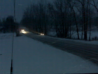
Warmer air intruded overnight and we had some rain instead of snow. Temperatures will drop today. Some additional snow is possible today as the storm wraps around and fills in behind the surge of colder air.


