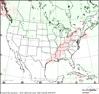
Widespread severe weather is likely for Sunday and Monday. This event will sweep across Texas to Iowa and points eastward. Sunday evening will see a battle between moderate tornado parameters verses a cap. If the cap can be overcome, central MO to central/northern IL will could see numerous tornadoes late afternoon into the evening. This system will lose some punch as it moves east towards Indiana but will regain some strength Monday mid day to late afternoon.
The tornado parameters are not as high in Indiana but we could still see some isolated tornadoes along with a strong linear threat on Monday. Storms should be east by early evening as much colder air will take over.
Any slow down in the eastward progression which was advertised a couple of days ago could again produce a much stronger outbreak including Indiana and Ohio.
There will be a lot of nowcasting with this event. Stay tuned...


No comments:
Post a Comment