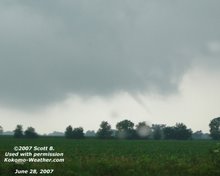
I thought I would look back for a few moments on the April 20th, 2004 tornado which struck Kokomo near Morgan St and US 31. My specific focus will be on the radar images from the event. I wanted to take a look at it to help me understand what to look for when I am at the radar and not out in the field spotting.
GRLevel3 is a wonderful (and affordable) application which displays level 3 radar data from the Nation Weather Service. Besides doing real time monitoring, you can also use archived data from available from the NWS website to replay events.
In the first radar image, you can get some overall size of the storm and structure. I find it interesting out the portion of the storm which hit Howard County is an off-shoot from the main line.  The next image shows the intensity of the storm and its size in relationship to Howard County and Kokomo.
 We skip forward 2 radar scans and can see the back edge is still building in intensity and changing shapes.
  Now lets zoom in even closer and look at the storm. The true intensity is likely hidden inside the storm but you can see a weak hook.
  The same radar image looking instead at the base velocity shows wind (precipitation) moving away and towards the radar. You can see a winds almost rotating from this image. It is at this time when the tornado is on the ground.
  The final reflectivity scan shows the storm has passed and weakened.
  The base velocity also shows the rotation is gone.
  If you scroll down to the bottom of this webpage, you can see some photos of the tornado by Charlie Sponaugle.
Here is a video on You Tube by Steve Conwell.
Thursday, March 8, 2007
April 20th, 2004 Tornado Revisited
Posted by
Jim
at
10:30 PM
![]()
Labels: GRLevel3, Howard County, Kokomo, tornado


No comments:
Post a Comment