The clipper drove on through and dropped about an inch. Amateur radio reports were mostly 1 inch this morning with 3 inches on the ground. It is warming up so the slight chance for precipitation for today will come as rain.
The warm up will come in over the weekend likely leaving just the man made snow piles by Sunday afternoon. Next week brings a storm that really has people excited. The NWS offices uses the phrase "slow and strong" to describe the system and tosses out "potential to produce heavy amounts of precipitation."
Now what does than mean? A lot of rain or a lot of snow or a mix. Snow does seem very possible with 4+ inches not all than unrealistic. It will take a couple of more day to get a real idea on what will be happening. Sunday evening will be my next detailed post on the upcoming storm.
In the mean time, enjoy the balmy weather and I will post a recap from the Severe Weather Symposium I am attending on Saturday.
Friday, February 29, 2008
As expected...
Thursday, February 28, 2008
Tonight's Snow & Next Weeks Confusion...
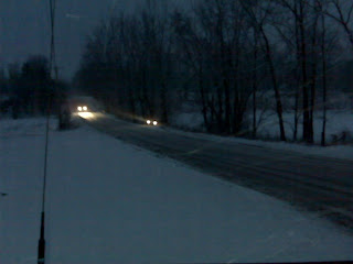
The clipper system tonight will be diving into our area pushing the snow ahead of it. The normal scenario is to have it come behind with the colder air. It is going to start as snow tonight but likely change to a mix to rain tomorrow morning. Some solutions show it remaining cold enough to stay all snow. Either solution will not have much moisture to work with so 1-2 inches will be all we should receive.
The morning drive to work or school could be another tricky mess. (I will spare you the lecture about driving for conditions.)
The weekend looks sunny and warm but some late Sunday precipitation keep creeping into the forecasts. That may drive down the expected high of 50 degrees.
The next big one...
The start of next week looks to be a wicked mess of weather. Models are flip-flopping almost with each run and doing it so wild I don't think anyone has a real handle right now. One of the major problems is the closed low pressure which is below the flow of the jet stream. Its path is very unpredictable. For us, we could see anything from warm with severe weather to a heavy rain storm of 2-3 inches to 6-12 inches of snow or a mix of everything. I think it is going to take some time to sort this one all out.
Wednesday, February 27, 2008
Our next clipper...
The clipper system coming in Thursday night and Friday will bring a couple of inches of snow. It looks colder on the models but the moisture isn't there to really produce a lot of snow. Some possible frozen precipitation is possible but doesn't seem likely.
A warm and what looks to be a dry weekend is ahead. Enjoy since next week looks to be a wicked mess. (The use of the word wicked is deliberate.)
Mid Day Update
The clipper event for Thursday night into Friday looks to start as snow dropping an inch or two before warm air turns in into rain. It should not be a problem except on road surfaces where drivers go too fast for conditions and end up sliding-off or causing an accident.
I know it sounds like a rant but the number of accidents I keep hearing on the police scanner is unbelievable. You can hear the frustration of the officers. Even when there are 2 or 3 slide-offs in a short stretch of road and a couple of officers on scene with their lights on, people continue to speed along and end up in the ditch. Slow down people, just slow down!
Back to the clipper system, the most recent model runs show it a little colder but I wouldn’t hold out hope for an all snow event. An all snow event would be 3-5 inches which seem unlikely.
Next week has a storm which looks like more rain for us than snow but it has shown some flip-flop on a few model runs so hope is there for a snow maker. Of course the snow maker solutions are so way overdone dropping 8-12 inches of the stuff which naturally makes is less likely to happen.
Next week is Severe Weather Preparedness Week. I will try to feature some severe weather information each day. You can find daily information from the NWS next week too. -CLICK HERE- Of course one very important thing is to have a severe weather radio for home and work. I will discuss those in more detail next week.
Tuesday, February 26, 2008
Very Poor Road Conditions Tonight
There are so many accidents the police are unable to respond to them all. On the east side of the county the are sliding off one right after another in front of the police. People are NOT slowing down and driving for conditions. Wake up people! You risk the lives of everyone with your reckless behavior.
My advice...
Stay off the roads!
Greasy Snow
That is the term to apply to the snow we just received. A typical snow ratio is 10-12 inches of snow for each inch of water (rain). The fluffy stuff can have ratios of 20 to 1. Lake effect can be 40 to 1 or higher.
The heavy wet snow we received has ratios of 2-4 to 1. Some people call this Greasy Snow. It can also be called Heart Attack Snow.
Imagine if we had fluffy snow overnight. A foot or more would have been on the ground today.
All but over...
The snow is all but stopped with some lingering flurries possible. The low pressure driving this system has moved over West Virginia and the NWS has dropped the advisory for our county and all counties south. The winds are picking up but I didn't see any real issues after taking a short drive in the county. The overnight/morning snow was very wet and heavy and isn't looking to blow around much.
Temperatures remain near the freezing mark and the roads look generally in good shape. A few scattered slick spots remain but driving with common sense should get you there fine. With that said, I hear of another accident on the scanner every few minutes. I guess some people don't get it.
For those keeping track of my snow day predictions, I predicted six. I currently have three. While I am not going to say uncle and give up yet, I do realize my opportunities are dwindling pretty quickly. There are several more storms on the long range models, most could end up with marginal temperatures and be hit or miss for our area. The daytime heating is starting to erode away the really cold temperature needed for snow.
I also want to commend the NWS office in Indianapolis. I might have sounded rather critical of their recent decisions regarding watches, warnings, and advisories and snow totals. In the end they did a much better job making the call than those of us that are weather weenies demanding our snow fantasies come true.
We (weenies) all believed the storm was coming south. It did moved south on the models the last 24 to 36 hours before the storm arrived and we convinced ourselves we were going to get a good dump. We were going to steal the snow from Wisconsin and Chicago which have record or near record snow totals. Unfortunately the southern track was not nearly as deep as we had hoped. While Milwaukee, Wisconsin busted on their early trigger for heavy snows and warnings, it didn’t translate into our miracle. Just above of our area the northern portions of Indiana did make out like snow bandits even before the lake effect kicked in. It just needed to come down another 75 to 100 miles like the models showed.
We also got a little fooled by the early snow and sleet. That came 6 to 8 hours early and that also contributed to some of the euphoria among the snow lovers. Of course the change back to rain while we slept brought down the snow totals. Again the NWS forecast was much more on target. Kudos to them.
So when will we see the next snow maker? Thursday night into Friday will be another clipper. Our best snows this season have been clippers. Maybe this one will surprise. If not, there is always next week. I just have to keep believing. *grin*

Snow...
Warmer air intruded overnight and we had some rain instead of snow. Temperatures will drop today. Some additional snow is possible today as the storm wraps around and fills in behind the surge of colder air.

Monday, February 25, 2008
[NWS] New Weather Story
It looks like around an inch has fallen already. Looks to continue overnight. Again, everything going as planned with the exception of the rain didn't happen early on. Temperatures are still right at freezing.
Overnight Forecast
Snow will fall overnight. My forecast of 4-6 inches remains valid for this storm. Winds will increase towards morning and continue through tomorrow night.
This is short as there isn't much to add to the already laid out forecast. Things are going perfectly as planned.
[NWS] Winter Weather Advisory Issued
...WINTER WEATHER ADVISORY IN EFFECT FROM 3 AM TO 8 PM EST
TUESDAY...
THE NATIONAL WEATHER SERVICE IN INDIANAPOLIS HAS ISSUED A WINTER
WEATHER ADVISORY...WHICH IS IN EFFECT FROM 3 AM TO 8 PM EST
TUESDAY. THE WINTER STORM WATCH IS NO LONGER IN EFFECT.
A MIXTURE OF RAIN AND SNOW WILL CHANGE TO ALL SNOW LATE TONIGHT.
THIS SNOW WILL CONTINUE ON TUESDAY AND TOTAL ACCUMULATIONS WILL
RANGE TO AS MUCH AS 5 INCHES IN THE FAR NORTHERN PARTS OF CENTRAL
INDIANA TO 2 TO 4 INCHES ELSEWHERE. IN ADDITION...WINDS OF 20 TO
25 MPH WITH GUSTS TO 40 MPH WILL PRODUCE BLOWING AND DRIFTING SNOW
ON TUESDAY.
A WINTER WEATHER ADVISORY MEANS THAT PERIODS OF SNOW...SLEET...OR
FREEZING RAIN WILL CAUSE TRAVEL DIFFICULTIES. BE PREPARED FOR
SLIPPERY ROADS AND LIMITED VISIBILITIES...AND USE CAUTION WHILE
DRIVING.
Snow Pouring In Kokomo
The snow came early in Kokomo. It was not forecast until early tomorrow morning but the change over came early.
Some Upgrades
The northern NWS office has upgraded their areas to a Winter Storm Warning. We will likely see one later tonight.
Storm Trending South...
As many of us thought yesterday, the storm would trend south. (The track is a general west to east movement.) Yesterday the heavy snow bands were Chicago to Detroit. The weather hobbyists were gloating, making snow maps with very unrealistic totals, and touting the NWS warnings. Well, the warnings have been downgraded (and our upgraded (or about to be upgraded)) and an almost comical AFD (Area Forecast Discussion) came Milwaukee, Wisconsin office this afternoon. (You have to love those NWS guys with a sense of humor when they are about to bust big on their forecast.)
AREA FORECAST DISCUSSION
NATIONAL WEATHER SERVICE MILWAUKEE/SULLIVAN WI
307 PM CST MON FEB 25 2008
SHORT TERM
TONIGHT-
JUST ABOUT READY TO WALK THE PLANK. WILL BE A SHARP
GRADIENT BETWEEN NOTHING NORTH OF A LINE FROM
MADISON TO MILWAUKEE AND SIGNIFICANT SNOW SOUTH
OF THE ILLINOIS BORDER. ONLY THE 12Z GFS STUCK TO
KEEPING DECENT QPF ALONG THE ILLINOIS BORDER COUNTIES.
EVERYTHING ELSE HAS JUMPED SHIP TO THE SOUTH...
WHICH HAS BEEN THE TREND FOR DAYS. IF ONLY I
HAD LISTENED.
Snow Update
The Winter Storm Watch goes along with my forecast for 4-6 inches. Look for rain early then a change over to snow around 4 AM. Gusty winds will cause blowing and drifting.
WINTER STORM WATCH IN EFFECT FROM TUES MORNING THROUGH TUESDAY EVENING.
A LOW PRESSURE TRACKING ACROSS THE OH VALLEY TONIGHT WILL BRING THE POTENTIAL FOR UP TO SIX INCHES OF SNOW LATE TONIGHT AND TUESDAY. STRONG NW WINDS OF 20 TO 25 MPH WITH GUSTS TO 40 WILL CREATE SIGNIFICANT AREAS OF BLOWING & DRIFTING SNOW AND VERY HAZARDOUS TRAVEL CONDITIONS.
WINTER STORM WATCH IN EFFECT FROM TUES MORNING THROUGH TUESDAY EVENING.
THE NATL WEATHER SVC IN INPOLIS HAS ISSUED A WINTER STORM WATCH.WHICH IS IN EFFECT FROM TUES MORNING THROUGH TUESDAY EVENING.
LOW PRESSURE WILL TRACK ACROSS THE OH VALLEY TONIGHT & STRENGTHEN RAPIDLY. AT THE BEGINNING OF THE STORM TONIGHT.PRECIPITATION WILL FALL AS RAIN AS TEMPS WILL BE ABOVE FREEZING.
HOWEVER.COLDER AIR WILL WORK TOWARDS DAYBREAK ON TUESDAY. AS IT DOES.RAIN WILL CHANGE TO SNOW FROM NO. TO SO. & WILL BE IN THE FORM OF ALL SNOW ACROSS CNTL IN BY NOON TUESDAY. SNOW WILL TAPER OFF DURING TUES EVENING.
THE POTENTIAL EXISTS FOR A SNOWFALL OF THREE TO SIX INCHES ACROSS CNTL & N. IN. THE HEAVIEST SNOW OF UP TO SIX INCHES WILL OCCUR ALONG & NO. OF A LINE FROM CRAWFORDSVILLE TO MUNCIE. TWO TO FOUR INCHES OF SNOW WILL BE POSSIBLE ACROSS CNTL IN INCLUDING THE INPOLIS METRO AREA.
IN ADDITION TO THE SNOWFALL.VERY STRONG NW WINDS OF 20 TO
25 MPH WILL DEVELOP EARLY TUES MORNING & CONTINUE THROUGHOUT THE DAY. GUSTS OF UP TO 40 MPH WILL BE POSSIBLE. THIS STRONG WIND WILL CAUSE SIGNIFICANT AREAS OF BLOWING & DRIFTING SNOW. STRONG WINDS WILL CONTINUE INTO THE OVERNIGHT HRS OF TUESDAY.
THERE REMAINS SOME UNCERTAINTY WITH REGARDS TO THE PRECISE TRACK OF THIS STORM. SMALL CHANGES IN THE EXPECTED TRACK WILL RESULT IN LARGE CHANGES IN THE AMOUNT & TYPE OF PRECIPITATION IN THE AREA.
A WINTER STORM WATCH MEANS THERE IS A POTENTIAL FOR SIGNIFICANT SNOW.SLEET.OR ICE ACCUMULATIONS THAT MAY IMPACT TRAVEL.
CONTINUE TO MONITOR THE LATEST FORECASTS.
No Advisory, Watch, Warning For Us...
Well, nobody at the Indianapolis NWS Office thinks the snow amounts will be very large for our area. It also is thought the change over from rain will be much later than earlier thought. You can get an idea from the area NWS offices what they are thinking.
Benton County is under a Winter Storm Warning and with White, Cass, and Miami Counties is under a Winter Storm Watch. I guess we wait and see what the day brings...


Sunday, February 24, 2008
Snow Forecast Update
The northern NWS office has pushed their Winter Storm Watch down to the southern most portion of their coverage area. This includes Cass and Miami counties. The weather models generally agree on a more southern track of the storm and almost all of them have come around over the course of the day.
Our local area will see either a Snow Advisory or a Winter Storm Watch very soon. While there have been a modest spread in snow totals, I think 4-6 inches would be a good call at this juncture. Blowing snow also looks likely with 20+ MPH winds on Wednesday. This could quite possibly be the multi-snow day event I have been looking for all season.
This will be a difficult week for the start of the Boys Basketball Sectionals. I can see many games being postponed this week. (Friday also still has a potential clipper system in the forecast bringing accumulating snow.)
Also given the relative short time between now and the snow system, advisories, watches, and warnings could come and be upgraded rather quickly. The front end of this does look to be a rain event before a very quick change over to snow.
(Oh, now would be the time to mob the grocery stores. *grin*)
Our Next Snow Is Monday Night Thru Tuesday
We are on track for another snow. The precipitation starts as rain late Monday into the evening and transitions into snow after midnight. Tuesday will be all snow. The main track of the snow is north but we will still see 3-5 inches. This will be a heavy wet snow so no wild accumulations.
The transitions also looks to be minimal so wither we see snow or we see rain. Sleet or freezing rain does not look probable. This system as 2 concerns with the first being warm temperatures. Should it be just slightly warmer, we might not get much if any snow.
The second concern would be a shift in the track. Nothing seems to indicate a shift north but a shift south seems more likely. A 50 to 100 mile shift would increase our totals to 6 or 8 inches.
Tonight’s model runs will be the first really good sampling of the system after it has passed over the Rockies. We can then get a good idea of the strength and some better idea on the track.
As soon as I see anything coming from the NWS for our area, I will get it posted. I suspect some form of advisory or watch will be issued in the next 6 hours.
I need to post this...
OK, I was planning on not watching the weather too much today but I did check in to see the models. Overall we look to not be in the main path of the storm but 2-4 inches look likely with the storm. This will come after several hours of rain.
However the experimental NAM (which is being tested before replacing the operational NAM forecast model) has a whole different solution. For what it is worth, the new NAM has been better with recent storms.
Just look at this dump of 10-12 inches for Howard County! Remember, it is just hype/eye candy/snow porn so don't run out and mob the grocery stores. *grin*
Friday, February 22, 2008
This storm is done...
The snow is all gone and other than some left over slick roadways, parking lots, and sidewalks, the weekend will be free from snow and other frozen precipitation. The sun will shine between the clouds bringing some melting to the snow.
Next week looks to be busy with a couple of systems with a bead on the Ohio Valley/Great Lakes. Stay tuned for news. I will bring details starting on Sunday evening unless someone gets nervous at the NWS and issues an advisory, watch, or warning for the first system early. (It is possible but not likely.)
Have a great weekend!

We are not done yet...
Not with this multi wave system or with winter weather. The current system is spinning up with another afternoon drive home whammy. Expect another slick drive home from work with low visibility. Expect another 2-3 inches with a possible mixing with sleet/freezing rain further south.
Once this passes through, we should be done with snow by midnight with the exception of some possible flurries. The weekend looks better with some warming.
Click on the image for animation of the storm.
Another system is heading our way for Tuesday into Wednesday. Rain is likely Monday evening before a change over to snow on Tuesday. This system looks to deliver 4-8 inches before it is all said and done. That 992 low looks pretty sweet for the snow lovers.
Good Morning...
The overnight didn't bring much if any precipitation to the area. Some additional snow or frozen precipitation will build again today and should bring another slick drive home. Accumulations will be around 1-2 additional inches of snow.
Once we get past tonight into the weekend, look for a dry weekend.
Our next system would be Tuesday and Wednesday where we could start off with rain before a change over to snow.
Thursday, February 21, 2008

Overnight Snow & Ugly Start Tomorrow
The snow will be light overnight but 1/2 inch to an inch could fall. It will be slick with limited visibility to start the day. One would expect 2 hour delays for area schools. The decision to cancel will be a tough one for administrators. Additional snow and some light sleet and freezing rain will happen through the day accumulating one to two inches.
Roads will be passable but slick. Motorists should slow down, take it easy, and allow plenty of stopping distance.
The NWS did downgrade the storm warnings for counties south of us to I-70 to a Winter Weather Advisory. This is not the kiss of death for the storm but in fact us good news. The ice expected is not likely to accumulate as much as first forecast. Snow will be the precipitation of choice.
Everything will be out of the area by Saturday morning.


Slick Roads/Snow Falling/Winter Weather Advisory Issued
The white stuff is falling and reports of slick roads and low visibility have been coming in from some friends and from listening to the scanner.
The NWS did issue a Winter Weather Advisory a few minutes ago...
...WINTER WEATHER ADVISORY IN EFFECT FROM 7 PM
THIS EVENING TO 7 PM EST FRIDAY...

THE NATIONAL WEATHER SERVICE IN INDIANAPOLIS
HAS ISSUED A WINTER WEATHER ADVISORY...WHICH
IS IN EFFECT FROM 7 PM THIS EVENING TO
7 PM EST FRIDAY.

A VERY STRONG LOW PRESSURE SYSTEM WILL MOVE
OUT OF TEXAS AND INTO KENTUCKY ON FRIDAY.
VERY MOIST AIR WAS MOVING UP AHEAD OF THE LOW.
THIS WILL SPREAD A MIXTURE OF SNOW AND SLEET
INTO THE AREA. BY FRIDAY AFTERNOON AROUND 2
INCHES OF SNOW MAY ACCUMULATE. THIS SNOW
WILL MIX WITH SLEET WHICH WILL CAUSE A GLAZE
ON THE SNOW.

IF YOU MUST TRAVEL USE EXTREME CAUTION. BE
PREPARED FOR WINTER DRIVING CONDITIONS.

A WINTER WEATHER ADVISORY MEANS THAT PERIODS
OF SNOW AND SLEET WILL CAUSE TRAVEL DIFFICULTIES.
BE PREPARED FOR SLIPPERY ROADS AND LIMITED
VISIBILITIES...AND USE CAUTION WHILE DRIVING.
Late Update
It has been hectic at work and I just got around to eating lunch and reviewing the information. Not much to update everyone on at this point. This storm will come in a couple of waves and the first wave is over our area. Precipitation is falling but not hitting the ground due to a dry atmosphere. Expect that to chance after nightfall. The NWS has not made any changes to its forecasts or advisories, watches, or warnings.
I have heard many reports from Missouri about 1 to 2 inches of sleep and snow reported by someone just south of the Quad Cities. They were not forecast for any snow.
Interesting Thoughts by NWS
This morning the NWS thinks Kokomo and Howard County will not see much concern with the upcoming system. One inch tonight with less than another inch tomorrow. A winter weather advisory is in effect for counties south of I-70. The models show a lot more QPF falling over our area so I am unsure what is driving their decision.
I will see what the morning model runs show and give a better idea on the thinking around lunch.
My call for the storm...
The storm is ready to spin up some action tomorrow. There are lots of different amateur and professional forecasters with as many different ideas. There are a handful of variables in play and one or more of these could have a dramatic effect on the outcome of precipitation and amounts.
One is the temperatures aloft. Surface temperatures are fine but some warm air aloft could bring sleet or freezing rain or even ice. Sleet seems to be the most discussed for our area but it will be a close call. In the past 24 hours the sleet line has moved 150 miles north.
The second variable is the precipitation amounts. Southern Indiana and
Those are the two biggest variables with the system. At this point we do look to not have any devastating ice event but could see a small amount (1/4” or less) of freezing rain. This will come in the middle of the multi-day winter weather event.
Some early snow will come tomorrow afternoon with the majority falling in the overnight before tapering off to freezing rain on Friday. Look for additional snow Friday evening through Saturday morning.
My call with this system currently is 2-4 inches by 7 AM Friday and additional 1-2 inches by 7 AM Saturday.
Wednesday, February 20, 2008
A Peek At Next Week...
Yes, I know everyone wants to know about the Thursday-Saturday storm but I figured I would throw you a bone about next week. The models have been showing a wide spread storm dropping a lot of precipitation across much of
But those with actual meteorology degrees and experience saw something else. They saw a potential “big daddy” storm that are ones that people remember for decades. While I won’t dwell on their reasons and analysis, I did find one thing that made me take notice.
The division of the National Weather Service decided they wanted more and better data for this storm and sent out a recon plane off the west coast to get more and better data. From what I gather, this is a very uncommon occurrence. Here is their mention in the afternoon discussion notes…
ORGANIZED RAIN/WINTER PCPN FOCUS HEADING
INLAND SEEMS ON TRACK TO REACH THE US WEST
COAST SUN...THE CENTRAL US MON...AND THEN
POTENTIALLY PHASE IN ADDITIONAL NRN STREAM
ENERGY/COOLING OVER THE E-CENTRAL TO ERN US
TUE/WED AS PER SIGNIFICANT PATTERN AMPLIFICATION.
A WINTER STORM RECON FLIGHT HAS BEEN SCHEDULED
OUT OF PORTLAND FOR USE IN TONIGHTS UPCOMING
00 UTC NCEP MODEL SUITE IN AN EFFORT TO GAIN
ADDITIONAL PRECURSOR ATMOSPHERIC DATA FOR
THIS SYSTEM THAT MAY LEAD TO DECREASED FORECAST
ERROR.
The Next Snow Maker...
While it seems to be a moot point with cloud cover tonight, you still might poke your head out to see the lunar eclipse.
This little clipper is on its last legs for us. The final snow squall is moving through but will not leave behind much accumulation. The ratio for liquid to snow was quite high with this system. Likely 15-20 to 1. That makes it very light and fluffy. Terrible for making snowmen but easy to clear away. (You could even use a leaf blower for today's snows.)
The storm for Thursday, Friday, & Saturday will not be a big monster but instead will be a spread out mess. Look for snow to start as early as tomorrow afternoon with the best accumulating snow falling between midnight and noon on Friday.
We will be near the mixing line and some sleet is expected during the afternoon on Friday before turning back to snow Friday evening into Saturday morning. I have not seen any snowfall totals from the NWS but models which have been pretty consistent and other forecasters are calling from anywhere 4 to 8 inches.
I would make an early call on 4-6 inches and a lot depends on the mixing of sleet with the snow. I don't see freezing rain or ice however coming into play this far north. My confidence level for this storm is high and my confidence level for a snow day for area schools on Friday is also high.
All Hail The Clipper
Before I provide a lunch update of the Thursday/Friday storm, let us have one more moment of praise to last nights clipper. It was a very nice surprise to is that expected it to drop the heavier snow south of Indianapolis. You can see we did very nice. I think when all is said and done we end up with 4-5 inches from this and will have a great start for the next snowfall coming tomorrow!
The Little Clipper The Could...
The overnight clipper produced a suprising amount of snow for most people. In fact it is still coming down! I have 4-5 inches at my house! Really!
I am not even going to think about next storm and am going to just enjoy this one...
Tuesday, February 19, 2008
Upcoming Snows
Tonight’s Snow
The snow for tonight will be associated with a clipper system and accumulations will be one to two inches for our area. I have seen some forecasters calling for more but the NWS and television forecasters have not been mentioning anything other than light snow or an inch or less.
If more does fall, then it will be a nice surprise for everyone. Unlikely for any snow day on Wednesday but area school could see a 2 hour delay with the system. Snow will be ending near 5 to 7 AM and a delay would allow for better road conditions once plows had a chance to go over the roads.
Addition to Forecast: Just as I posted this, the NWS in Indianapolis decided to acknowledge the snow for tonight.
SNOW ACCUMULATIONS ARE LIKELY TONIGHT. AROUND
AN INCH IS EXPECTED FROM LAFAYETTE AND KOKOMO
SOUTH TO JUST NORTH OF INDIANAPOLIS. 1 TO 2
INCHES ARE EXPECTED FROM INDIANAPOLIS SOUTH TO
BLOOMINGTON...AND 2 TO 3 INCHES ARE EXPECTED
SOUTH OF BLOOMINGTON. THE SNOW WILL BEGIN FROM
WEST TO EAST STARTING LATE THIS EVENING AND
CONTINUING OVERNIGHT.

MOTORISTS SHOULD BE ALERT TO SLICK ROADS AND
OCCASIONAL VISIBILITY AROUND A QUARTER MILE.
Thursday Evening into Friday
There is still a lot of uncertainness associated with this storm system. Nobody is making a call on accumulations and mixing of rain/sleet/snow/ice is very possible for the southern portions of
If the better moisture stays south, then we might end up with 1-2 inches. If it trends north as has been the case all season long, then a 4-6 inch snowfall looks more likely. The system should leave the area by Friday being a slight warm up for the weekend.
Next week looks to be setting up for another system or two across the area with many questions so while March is near; winter wants to provide us with a few last hurrahs.
Friday Snow Map
Here is an early snow map for the Friday event.
The HPC is also giving some credence to the possible snow.
Monday, February 18, 2008
Two Snows This Week...
Well, maybe...
The first snow is Tuesday evening into Wednesday with a clipper system digging in across the area. Only a few forecasters are thinking the clipper will bring accumulating snow. Most including the NWS are dismissing it calling for no accumulations to a trace. Chris Wright from Channel 13 threw around the call for an inch.
Earlier today I posted Margusity’s map of 3-6”. A call of from Indiana Weather Online is for 3-5” across a large area with a specific call of 3-4” for
The good news is this one could surprise us all. Sometimes those are the best snows.
Central Indiana Severe Weather Symposium
I kept thinking there would be a slow weather week to talk up the Central Indiana Severe Weather Symposium but it seems there hasn't been a slow week for a while. If you want to learn more about severe weather, this all day advanced seminar sponsered by the Indianapolis National Weather Service would be for you. Visit here for more information.
A Snow Map For Julie...
One of my loyal blog readers asked me if I could find any snow on the maps and I said things look bleak. But I did find one person, Henry Margusity at Accuweather, hyping the clipper coming trough Tuesday into Wednesday. He thinks the snow ratios will be very high with cold artic air being overrun by the warm air in the south. He gave us a 3-6" snow possibility. The NWS discounts this system and says there will be no measurable precipitation from this system. Of course they might be really, really gun shy given the recent history of busted forecasts. If this does look possible to the NWS, I would expect them to start mentioning it more in the overnight after the 00z model runs.

There has been a lot of talk about busted forecasts and where did the snow go? As mentioned many times, the models show it for us and then the storm tracks to the northwest. This is very evident from the snow totals around the area.
Here is a breakdown of snow accumulations to date and the departure from norm.
MN
Duluth: 49.1" (-9.5)
International Falls: 54.0" (+2.4)
Minneapolis/St. Paul: 23.9" (-15.1)
WI
Green Bay: 71.4" (+33.9)
La Crosse: 57.8" (+25.5)
Madison: 83.7" (+47.8)
Milwaukee: 76.1" (+37.8)
MI
Marquette: 127.0" (-0.8)
Alpena: 66.9" (+6.1)
Detroit: 38.3" (+6.3)
Flint: 68.2" (+33.5)
Grand Rapids: 84.9" (+28.7)
Sioux City: 35.8" (+14.2)
Des Moines: 48.4" (+21.9)
Dubuque: 60.6" (+29.5)
IL
Rockford: 59.5" (+30.6)
Moline : 42.4" (+15.8)
Chicago: 45.2" (+18.0)
Peoria: 27.2" (+7.3)
Springfield: 25.1" (+6.8)
IN
South Bend: 60.6" (-0.4)
Fort Wayne: 28.0" (+1.2)
Indianapolis: 17.3" (-4.1)
Evansville: 6.7" (-4.3)
OH
Cleveland: 31.7" (-12.6)
Toledo: 24.7" (-2.4)
Youngstown: 62.7" (+24.6)
Columbus: 17.0" (-4.5)
Cincinnati: 8.3" (-8.7)
Dayton: 15.0" (-6.4)
KY
Total Lunar Eclipse This Week (Wednesday Evening)
A total lunar eclipse this week visible from Indiana. The bad news is it looks to be cloudy according to the forecasts. Reference the NASA site here for additional information. I also included a general purpose time chart below.
Just a heads up for a Total Solar Eclipse. Indiana/Illinois looks to be the sweet spot to see one in August of 2017. Don't miss it. *grin*
Sunday, February 17, 2008
Becoming Colder...
It isn't nearly as dramatic as we had recently with a very warm day and a cold front moving through being colder temperatures but the cold is coming. With 57 at 3 PM to 43 at 7 PM, you can sure feel it. The double good news is we didn't have any severe weather this time around and the temperature won't be a frigid with an overnight low of 30.
Some light snow, less than in inch, will happen overnight into tomorrow. Tomorrow will see more falling temperatures down to single digits be Tuesday morning. Wind will continue to be gusty over the next couple of days too.
I figure I should mention big monster snow we didn't receive. It did materialize and gave a nice dumping to parts of Wisconsin, Iowa, and Michigan. It also didn't become the monster blizzard expected and remained more like other snows dropping from 6 to 12 inches with modest winds. (As a snow lover that would have been great to see here.)
The wrap around back side snow also is not happening. The storm is moving a lot faster that thought and the mositure just isn't there to support it.
Some more possible snows are on the forecast models. None look to be spectacular but a few could bring enough for a snow day. (Man do I need a snow day in the most desprate way to make my prediction.)
No Watch but Severe Weather Possible
Full Discussion Here
ISOLATED HAIL AND/OR A DAMAGING WIND GUST/BRIEF TORNADO NOT OUT OF THE QUESTION ALONG THE IL/IN BORDER NEWD TO SWRN LOWER MI NEXT COUPLE OF HOURS.
High near 60 expected...
A high near 60 look very possible with us already at 55. This might increase our chances for some severe weather later in the afternoon/early evening.

WIND ADVISORY FOR SUNDAY
...WIND ADVISORY IN EFFECT UNTIL 7 PM EST THIS EVENING...
THE NATIONAL WEATHER SERVICE IN INDIANAPOLIS HAS ISSUED A WIND ADVISORY...WHICH IS IN EFFECT UNTIL 7 PM EST THIS EVENING.
WINDS THIS AFTERNOON ARE EXPECTED TO REACH 35 MPH WITH GUSTS TO 45 MPH.
A WIND ADVISORY MEANS THAT WINDS OF 35 MPH ARE EXPECTED. WINDS THIS STRONG CAN MAKE DRIVING DIFFICULT...ESPECIALLY FOR HIGH PROFILE VEHICLES. USE EXTRA CAUTION.

Sunday Weather...
Without looking ahead, Sunday will be warm (lower 50's) and windy. The dryslot which usually robs our snow will today rob us of rain. That is great news for saturated ground and swollen waterways.
While we are under a general risk for thunderstorms today by the SPC, don't look for anything severe until the cold front moves through and we see another dramatic drop in temperatures with gusty winds.
Now that I am back in the comfort of my home, I will get back to reviewing the weather for Kokomo and Howard County. The trip did prove a great test of posting information, even if it was not weather related in this case, from my new Blackberry Pearl.
Saturday, February 16, 2008
Plymouth 30 NW 21
Plymouth has a few foul problems. NW needs to capitalize.
Sent from my Verizon Wireless BlackBerry
Let the game begin.

Good luck to Kokomo tonight too.
Sent from my Verizon Wireless BlackBerry
Sunday looks wet and stormy...
Thunderstorms seem to be the story tomorrow. The severe ones should be in the outher area/states. However heavy rain can happen with these storms. Some frozen rain may accumulate in the early morning hours before changing to all rain.
Once back home tomorrow I can get back to regular and more detailed updates.
Calumet 45 NW 45
After 3 quarters of play. Momentum Calumet.
Sent from my Verizon Wireless BlackBerry
Plymouth Wins in OT
Northwestern is warming up for Calumet...
Sent from my Verizon Wireless BlackBerry
Go Tigers

Sent from my Verizon Wireless BlackBerry
Severe Weather Sunday
The SPC has us under a general risk for severe weather for Sunday. Temperatures will be very warm before the cold front moves through being the chances for light snow on Sunday noght and Monday.
Friday, February 15, 2008
Weather Update
back to weather...
Sunday is getting warm. I wonder if severe weather will be a threat?
I see highs approaching near 50.
Sent from my Verizon Wireless BlackBerry


Rain, Rain, Go Away...
Come again another day. Without much fanfare, the big monster snow storm looks to have left a huge portion of the Midwest & Ohio Valley leaving a wet mess with 1-2 inches of rain for many areas, us included.
With all of rain associated with the system, watch for flood statements over the weekend.
I will be on a mini road trip to Chicago today with might send a few pictures from my phone so look for some non weather related posts today.
Thursday, February 14, 2008
Let's Get Right To It...
The model runs for the Sunday/Monday look terrible. The rain has taken over as the low pressure moves to the west allowing the warm air to move over the area. Over an inch of rain looks likely. The NWS has added the threat for freezing rain Saturday night into Sunday morning. Some back side snow still seems likely on Monday.
At this point I have a very low confidence for significant accumulating snow with this monster storm. Somebody will get hammered by this beast but it doesn't look like us.
Another update tomorrow around lunch before I head to Chicago and Rensselear for a couple of days.
The next two snows!
Snow is coming! Yes, there will be snow and someone is going to get a lot of it.
Our first snow event is overnight tonight into Friday. Not much accumulation is expected but the coating could result in some slick roads and sidewalks. With the number of snows we have had this year, one would expect driver would slow down and drive with caution but I can say by listening to the local law enforcement online at Scan Kokomo that just isn’t the case. Just slow down and arrive safely.
The big storm which would be the biggest of the season is heading toward the Midwest and
Our snow will be hampered by warm air on Sunday. While the forecast models cannot agree on how far the warm air surges, all agree it is as far as north central
Even with the snow, there will be enough rain that flooding can become a concern again for many people who have already been flooded several times this year.
I promised you a snow map so here is the morning run of the GFS and its thinking for the storm. Enjoy it and proceed with caution. Anything can and will happen.

Wednesday, February 13, 2008
Friday Snow
The snow Friday and into Saturday looks to be pretty light right now. Maybe an inch or two in some lucky spots. I won't give it any concern.
The big storm for Sunday and Monday is still in track for someone in the Ohio Valley/Great Lakes. There is a pretty wide disagreement between weather models and meterologists so no prediction on amounts yet. Tomorrow should bring the start of some snow maps so I can post a few.
I am not sure when I will make my final call on this storm given I either have to do it early on Friday and very, very late on Saturday/Sunday morning. Not a good time to be on a road trip and without the Internet.
I hope you like snow...
The good news for me is I think I hit my 2-3" prediction for the snow storm. It did make for some tricky driving yesterday afternoon in the the evening.
Snow for Friday looks on track. The big snow for Sunday into Monday seems to be shaping up. Several models are showing the convergence of 2 lows making one heck of a monster possible. Keep watching for more...
Here is Tom Skilling's update from WGN 9 in Chicago. Some good stuff for us...
Tuesday, February 12, 2008
Friday Snow & Sunday Snow
It looks like we are finished with the snow for now. It will be colder however tomorrow.
Friday looks to have snow across the Ohio Valley and Great Lakes. Sunday into Monday looks to be one of the bigger snows for the area.
No update until late Wednesday after I make a daytrip to Bloomington and then get back for basketball in Kokomo.
Snow Falling
In a suprise turn of events, snow is falling over the area and the radar is filling in through IL. Maybe something to keep an eye on for the evening drive home.
It happened again...
Looks like a repeat of the previous week were everyone busted on the forecast. Even my low call of 2-3" was too high for our area. We have 1/2" to 1" reported. I also got the 2 hour school delay incorrect. Drat!
It was a good snow for those south and in Louisville. They had one of their best snows in several years. Places south of Indianapolis did pick up snow and many schools are closed are delayed.
So what is in store for us now? Maybe a weekend storm on Friday into Saturday. One model shows it and one doesn't. The good news is it isn't projected to be a monster. Just some light snow and modest accumulations.
As for larger snows, there are many of them showing up on the 15 day forecast. All of these have 6" plus potential. Dates are 2/18, 2/21, 2/24, and 2/28. Of course they could all be called weather eye candy at this point since snow track forecasts 12-24 hours cannot even be right. My prediciton is one of these will be a monster but everyone from forecastsers to the general public will ignore it given the recent history of busted forecasts.


Monday, February 11, 2008
NWS DOWNGRADES ACCUMULATIONS
The accumulations are downgraded for our area and much of the area covered by the NWS Indy office. They are now calling for 2-3" for Kokomo. (Yes, that was my final call at noon today!) Overnight amounts will be one inch with one to two more possible tomorrow.
I would likely expect to see our advisory canceled by morning.
18Z NAM gives us very little...
Animated Image - click to enjoy. (The snow all but misses us with the afternoon run. Maybe an inch.)

