Hopefully race day Sunday will be the same but there is a small chance for scattered thunderstorms. Monday will see a better chance for thunderstorms. I am watching some potential for severe weather either Wednesday or Thursday. Too early to get to worked up about it for now but something to track.
Saturday, May 29, 2010
Thursday, May 27, 2010
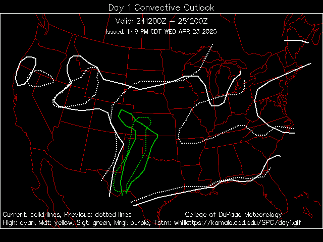
Thursday's Potential Thunderstorms
Some possible thunderstorms today for our area and better chances to our south or west. A storms could be strong but nothing severe is expected. Storms have been slow movers and can produce a lot of rain. Should one form over the Howard county area, expect it to linger for a while.
The forecast through race day looks great. Some scattered thunderstorms arrive for Monday and I could see a few arriving late on Sunday but wouldn't expect any outdoor plans to be disrupted or the race to be shortened. It will continue to be warm into next week.
Wednesday, May 26, 2010
Thunderstorms and Race Weekend
Minimal chance for a pop up thunderstorm today with better chances on Thursday. Nothing widespread or severe forecast.
Friday will begin a 3 three day stretch of near perfect weather with highs about 80 and low humidity. Race day will be about as perfect for fans as you can get. Enjoy.
Monday, May 24, 2010
Easy Forecast...
The forecast is rather easy for the week. It will be hot and dry with temperatures in the middle to upper 80's before cooling down to the upper 70's to near 80 for Friday and the weekend. Overall it looks dry but a pop up shower or thunderstorm is possible each day. The chances are pretty low for that to happen but I wanted to mention it just in case.
No severe weather currently forecast this week so enjoy.
Friday, May 21, 2010
A Great Weekend Forecast
Yep, you read it correctly. The weekend looks to be great with one exception...
Sunday might be a bit on the warm side with a high near 90 degrees. Be sure and enjoy plenty of liquids. :)
SEVERE THUNDERSTORM WATCH UNTIL FRI AT 9:00 PM FOR KOKOMO, IN
WWUS63 KIND 211734
WCNIND
WATCH COUNTY NOTIFICATION FOR WATCH 199
NATIONAL WEATHER SERVICE INDIANAPOLIS IN
134 PM EDT FRI MAY 21 2010
INC005-011-013-015-021-023-027-031-035-045-055-057-059-063-065-
067-071-079-081-083-093-095-097-101-105-107-109-119-121-133-135-
139-145-153-157-159-165-167-171-220100-
/O.NEW.KIND.SV.A.0199.100521T1734Z-100522T0100Z/
THE NATIONAL WEATHER SERVICE HAS ISSUED SEVERE THUNDERSTORM WATCH
199 IN EFFECT UNTIL 9 PM EDT THIS EVENING FOR THE FOLLOWING AREAS
IN INDIANA THIS WATCH INCLUDES 39 COUNTIES
IN CENTRAL INDIANA
BARTHOLOMEW BOONE CLINTON
DECATUR HAMILTON HANCOCK
HENDRICKS HOWARD JOHNSON
MADISON MARION MORGAN
RUSH SHELBY TIPTON
IN EAST CENTRAL INDIANA
DELAWARE HENRY RANDOLPH
IN NORTH CENTRAL INDIANA
CARROLL
IN SOUTH CENTRAL INDIANA
BROWN JACKSON LAWRENCE
MONROE
IN SOUTHEAST INDIANA
JENNINGS
IN SOUTHWEST INDIANA
DAVIESS GREENE KNOX
MARTIN SULLIVAN
IN WEST CENTRAL INDIANA
CLAY FOUNTAIN MONTGOMERY
OWEN PARKE PUTNAM
TIPPECANOE VERMILLION VIGO
WARREN
THIS INCLUDES THE CITIES OF...ANDERSON...BEDFORD...BLOOMINGTON...
COLUMBUS...CRAWFORDSVILLE...FRANKFORT...INDIANAPOLIS...KOKOMO...
LAFAYETTE...MUNCIE...SEYMOUR...SHELBYVILLE...
TERRE HAUTE AND VINCENNES.
SLIGHT RISK FOR SEVERE WEATHER FOR KOKOMO, IN
The Storm Prediction Center has issued a SLIGHT RISK for severe weather today.
There is a 15% chance for signficant hail.
There is a 15% chance for damaging wind.
Rain & Thunderstorms For Friday
Over half of an inch of rain has fallen with the first wave and more is expected. We could see more than an inch locally. The SPC has put us under a slight risk for severe thunderstorms with the greatest threat this afternoon and early evening.

The warm up starts tomorrow with a high near 80 and begins in earnest on Sunday when we approach 90. Next week looks hot...
Thursday, May 20, 2010
Rain and then Hot, Hot, Hot...
A few strong storms are expected tonight and Friday. Total rain amount should be around 1/2 to 3/4 inch.
Then a significant warm up will bring summer like temperatures for the weekend and through next week. It will be the first test for many air conditioners and I suspect many people will need service. It will be a long week for HVAC repairmen. No rain is expected through the end of next week at this time.
Decent Day...
Today should be a good day for the track. While there could be spotty showers, I would not expect a washout of practice. Fast Friday on the other hand will not be a good say from the looks of things. I changed my vacation days at work to go to the track today rather than tomorrow given the rain situation.
Looks to be dry and warmer for the weekend and next week.
Wednesday, May 19, 2010
A couple of nice days...
I think that Wednesday and Thursday will be nice weather allowing for grass mowing and practice at the track. Showers return Thursday night and hand around for Friday. There could be significant disruptions of practice for the Indy 500 on Friday.
Saturday looks to have thunderstorms but they will be spotty so no wash out but it could cause problems with the new qualifying format. Saturday will also be the start of the warm up. Saturday will be near 80 degrees and then Sunday will start the week long string of temperatures in the middle 80s. It will be warm...
Widespread severe weather is forecast but a few storms could be strong on Saturday.
Sunday, May 16, 2010
Catching Up & Looking Forward...
It has been busy since the big Thursday bust. I went out of town for a couple of day to the Dayton Hamfest. For those unfamiliar with the Dayton Hamfest, it is the largest gathering of amateur radio operators in the world every year. Dealers and equipment manufactures show off their new wares and you can find just about anything in the flea market area. My flea market find was a 25 year old mobile antenna made for public safety. It was brand new and never opened.
Of course before I left for the hamfest, there was one tiny bit of excitement. There was a storm cell which moved across Howard County just after midnight which showed rotation on radar. Unfortunately it was a bit unexpected and getting spotters out to look at the storm and determine rotation was a challenge. The good news is we managed to get some eyes on it and even better news is nothing touched down in Howard County. There was a brief lowering in Grant County which touched the ground but caused no damage.
The week coming up doesn't look favorable for practice for the Indianapolis 500. Rain chances are there Monday through Thursday. The bigger teams will be ok with limited practice time but smaller teams will need the on track time to get up to speed. I will be at the track Friday, Saturday, & Sunday and I expect a lot of action and the early forecast looks good but as always, anything can change so stay tuned...
Thursday, May 13, 2010
TORNADO WATCH UNTIL THU AT 9:00 PM FOR KOKOMO, IN
WWUS63 KIND 131750
WCNIND
WATCH COUNTY NOTIFICATION FOR WATCH 167
NATIONAL WEATHER SERVICE INDIANAPOLIS IN
150 PM EDT THU MAY 13 2010
INC005-011-013-021-023-027-031-035-055-057-059-063-065-067-071-
079-081-083-093-095-097-101-105-109-119-133-135-139-145-153-159-
140100-
/O.NEW.KIND.TO.A.0167.100513T1750Z-100514T0100Z/
THE NATIONAL WEATHER SERVICE HAS ISSUED TORNADO WATCH 167 IN
EFFECT UNTIL 9 PM EDT THIS EVENING FOR THE FOLLOWING AREAS
IN INDIANA THIS WATCH INCLUDES 31 COUNTIES
IN CENTRAL INDIANA
BARTHOLOMEW BOONE CLINTON
DECATUR HAMILTON HANCOCK
HENDRICKS HOWARD JOHNSON
MADISON MARION MORGAN
RUSH SHELBY TIPTON
IN EAST CENTRAL INDIANA
DELAWARE HENRY RANDOLPH
IN SOUTH CENTRAL INDIANA
BROWN JACKSON LAWRENCE
Tornadoes
Late afternoon and evening look like the best chances for weak tornadoes over parts of Indiana and northwest Ohio.

SLIGHT RISK FOR SEVERE WEATHER FOR KOKOMO, IN
The Storm Prediction Center has issued a SLIGHT RISK for severe weather today.
There is a 5% chance for tornadoes.
There is a 15% chance for signficant hail.
There is a 30% chance for damaging wind.
Wednesday, May 12, 2010
Thursday Thunderstorms
I am still liking our chances for a thunderstorm or two on Thursday. Mainly from 3 PM to 10 PM. More details tomorrow as they unfold.
Thunderstorms Wednesday & Thursday
Thursday afternoon and early evening will be the best for severe weather bust anytime today and tomorrow could see thunderstorms. Kokomo remains just north of the slight risk area for now but as storms move northeast and depending where the frontal boundary sets up, we could be included in later updates.
Nothing looks as ominous as last Friday when we busted big time.
Tuesday, May 11, 2010
Rain & Severe Weather
Rain today with thunderstorms possible. Some could reach severe limits. Some scattered rain and thunderstorms for Wednesday and then what could be another busy day with severe weather returns for Thursday.
So far we have picked up 3/4" of rain since midnight.

Sunday, May 9, 2010
Wet Week...
This week looks to have rain or thunderstorms every day. Monday should see a huge severe weather outbreak in Kansas, Oklahoma, and Missouri. Looks like a true high risk day. For Tuesday, the severe weather threat is for Ohio and portions of Indiana (not including us). I will wait for now to see how much this could effect us.

Saturday, May 8, 2010
Friday Storm Chase
A nice recap of a storm chase starting out in NE Indiana by Adam Lucio can be found here - http://www.aerostorms.com/050710-holgate-ohio-strong-wind-and-large-hail.php
Friday, May 7, 2010
I bust again...
Anyone want to suggest a new hobby? Apparently I am not very good at this one.
All I can say is I am sorry for the hype about severe weather today. All signs pointed to at a minimum straight line wind damage and good size hail. Several rounds were expected with discrete supercells leading ahead of a squall line. The camps were about evenly split on whether storms would go tornadic.
Watching the day progress, about everything spelled trouble. Lots of daytime heating, severe weather parameters shooting through the roof and even the tornado parameters were good enough for some spin ups. By 4 PM when nothing was convecting, I became worried. When things did finally get going, hardly anything reached severe limits and only a couple of storms nearby became strong.
Overall Indiana busted hard. A few warnings around the state but nothing like anyone forecaster So far the only thing I heard was a miss were the forecast dew points were 2 or 3 degrees cooler than the models kept showing. I know dew points are critical but this was beyond belief.
Look for a crummy weekend with cool temperatures and maybe some remaining showers on Saturday before lunch. Should I even mention next week has the potential for more severe weather? Nah.
TORNADO WATCH UNTIL FRI AT 11:00 PM FOR KOKOMO, IN
WWUS63 KIND 071932
WCNIND
WATCH COUNTY NOTIFICATION FOR WATCH 143
NATIONAL WEATHER SERVICE INDIANAPOLIS IN
332 PM EDT FRI MAY 7 2010
INC005-011-013-015-021-023-027-031-035-045-055-057-059-063-065-
067-071-079-081-083-093-095-097-101-105-107-109-119-121-133-135-
139-145-153-157-159-165-167-171-080300-
/O.NEW.KIND.TO.A.0143.100507T1932Z-100508T0300Z/
THE NATIONAL WEATHER SERVICE HAS ISSUED TORNADO WATCH 143 IN
EFFECT UNTIL 11 PM EDT THIS EVENING FOR THE FOLLOWING AREAS
IN INDIANA THIS WATCH INCLUDES 39 COUNTIES
IN CENTRAL INDIANA
BARTHOLOMEW BOONE CLINTON
DECATUR HAMILTON HANCOCK
HENDRICKS HOWARD JOHNSON
MADISON MARION MORGAN
RUSH SHELBY TIPTON
IN EAST CENTRAL INDIANA
DELAWARE HENRY RANDOLPH
IN NORTH CENTRAL INDIANA
CARROLL
IN SOUTH CENTRAL INDIANA
BROWN JACKSON LAWRENCE
MONROE
IN SOUTHEAST INDIANA
JENNINGS
IN SOUTHWEST INDIANA
DAVIESS GREENE KNOX
MARTIN SULLIVAN
IN WEST CENTRAL INDIANA
CLAY FOUNTAIN MONTGOMERY
OWEN PARKE PUTNAM
TIPPECANOE VERMILLION VIGO
WARREN
THIS INCLUDES THE CITIES OF...ANDERSON...BEDFORD...BLOOMINGTON...
COLUMBUS...CRAWFORDSVILLE...FRANKFORT...INDIANAPOLIS...KOKOMO...
LAFAYETTE...MUNCIE...SEYMOUR...SHELBYVILLE...
TERRE HAUTE AND VINCENNES.
Anticipation...
Things still look like strong to severe weather including tornadoes are very likely today. The start is a bit later than I anticipated but the daytime heating is adding more fuel for when this does erupt. I do not think we will bust today.
SLIGHT RISK FOR SEVERE WEATHER FOR KOKOMO, IN
The Storm Prediction Center has issued a SLIGHT RISK for severe weather today.
There is a 5% chance for tornadoes.
There is a 30% chance for signficant hail.
There is a 30% chance for damaging wind.
Be Alert On Friday
Kokomo & Howard County is in a moderate risk for severe weather. It will be super day for supercells. (Yes, I know that was really bad.)

A strong thunderstorm rolled through already this morning.

Reed Timmer from Discovery's Storm Chasers is targeting northeast Indiana and northwest Ohio for severe weather. Look for him and his Dominator out on the roads. Reed said today will be huge. We'll see...


Check back here often today for updates and keep your weather radio handy and stay tuned to local radio or television for information.
Thursday, May 6, 2010
Friday's Forecast *Severe Weather Likely*
Before I give a forecast, I first need to touch on the topic of chaser/spotters and severe weather. It is sometimes hard to understand how chasers/spotters can get so excited over storms which can cause death and destruction. Other than a few chasers/spotters who must not be human, nobody wishes for worst. However mother nature will give both good and bad weather and should bad weather happen, a weather enthusiast will want to witness it and hopefully use their skills to alert and warn others and save lives.
I think also there is a bit of man vs. nature and if we can see the severe weather (tornado) and not be harmed by it, then we can feel like we maybe won a little bit. I guess it is like those who chose to climb Mount Everest or run with the bulls. And of course like those adventures, we can also feel disappointment is we are unable to compete. Sometimes we are hyped and ready and like has happened recently, nothing materializes. Never take chasers/spotters excitement or disappointments over severe weather events out of context thinking we want or wanted to see your house destroyed or people dying in anyone's community.
With that said, I can say I have mixture of excitement and a bit of dread with tomorrow's forecast.
The event for Friday has been on the minds of forecasters and chasers for more than a week. This event has been pretty well advertised by all of the weather models and while there have been some minor adjustments/tweaks as we draw closer to the event, the forecast area and intensity of the event has been pretty stable.
Overall we remain under a slight risk for severe weather for Friday. We are just on the western edge of the highest probability for severe weather. I think that unless there is widespread ongoing rain across the area, I suspect that an upgrade to a moderate risk will occur with us remaining on the western edge. I even think there is a small potential for an afternoon upgrade to high risk to our east.

Looking at the plans of other chasers who target specific locations in anticipation of severe weather happening, I have seen Marion Indiana/Gas City listed as a starting point. That does make sense given the group thinking is the action will be best in northwest Ohio. Others are going directly to the northwest Ohio directly.
There has been some question if there will be tornadic development this far west. Some have downplayed the idea while others remain bullish. I won't make a call either way but will only say stay alert. I am confident there could be a fair amount of wind damage from the severe weather and we may see a lot of hail reports. While it is not all that rare to see hail in Indiana, there does look to be a good chance for severe 2+ inch hail. Now that will leave both a mark on you and your car.
The storms look to have good height. Normally we think 30,000 to 35,000 ft tops in Indiana. Tops of 50,000 ft look likely. The storms should start going just after lunch and then wind down by late evening. Minimal threats after dark are the thoughts for now.
Both discrete supercells and linear (squall) line convection are both likely and bow echos on with the linear stuff. Here is a 4 PM map showing warm temps, nice cape, wind, and isolated supercells.

I cannot stress the need to be alert tomorrow. Much of this action will be during work and school hours so think about what you need to do to protect yourself when you are not at home. If your workplace doesn't have a severe weather radio, it might be wise to get one today in preparation.
Edit to add: here are some other thoughts on the Friday...
http://blogs.wlfi.com/2010/05/06/new-post-soon-12
http://www.nciwx.com/
http://indianaweatheronline.wordpress.com/2010/05/06/severe-storms-likely-friday/
Wednesday, May 5, 2010
Much to cover tonight...
I have several things I need to cover with tonights blog. Let me start with a bit of a story about tonights storm system.
Out in the plain states, it is not uncommon to find a lot of chasers. Chasers come in all forms from media sponsored to hobbyist to those looking for video and photos to sell. A few are participating in science and then there are those which take other on chaser vacations. The running joke (if you can call it that) is people in small towns usually have one of those "Oh Crap!" moments when there is a caravan of storm chasers camping out in their town waiting for the storm.
I think most weather enthusiasts around Indiana today had reasonable expectations thinking there would be a few severe thunderstorms with hail and wind. No tornadoes seemed highly likely. Storms really blew up fast. In just a couple of scans of the radar (less than 10 minutes), they went from nothing to 30,000 foot tops. I use a radar application on my desktop called GRLevel3 which is top notch. You can customize it many ways and one of the things I do is load the locations of storm spotters who have equipment to provide automatic updates from the field.
There are not many in Indiana who do this but out in the plain states, this is rather common. Oddly enough, I noticed someone was updating their location just a few miles from my house! It was Charles Edwards the owner of Cloud 9 Tours who had had two vans and a SUV full of people waiting for the same storms to initiate as me. (There were sitting just west of Middleton.)
"Oh Crap!"
After a brief pause, I went back and looked over the severe weather parameters and saw they remained good for strong to low end severe thunderstorms. So the good news is Charles and company were not sitting here awaiting the big monster tornado to wipe out Kokomo. They were just hoping to be in the best position possible for what did happen.
For me, I made a huge blunder with tonight's storms. I saw what looked like a good storm over in western Carroll County and saw it was just going to slide north of Howard County. I thought the other storms forming behind it and just south would be just as good or better and that there would be a good stream of them coming through. I decided to take 20 minutes and a quick dinner with my wife. Dumb...
I waited too long on Monday to get out before the storm rolled though and missed some good structure pictures. When I finally left eh subdivision, I hit rain instantly. Phooey. Tonight I sate during what was the best and only storm of the evening. Phooey again.
I did wait it out for another hour or so when I did head out but it ended up being fruitless. I got a few photos like the one in the previous blog post. On the other hand, Cloud 9 Tours got on that storm and the best I can tell followed it for a while seeing hail. More phooey.
So I did make one resolution, I will watch to see what they do on Friday. Friday looks interesting for Indiana and Ohio so I assume the team will be back.
Friday is one of the things I want to hit on tonight. There are a lot of things which make one pause and think about a potential outbreak. I would not be surprised to see a moderate risk out for Indiana and Ohio come Friday noon. I could even see Ohio getting in on a high risk if things come together. But like has happened a lot recently, there always seems to be an ingredient missing, Friday is no different. Potential problems include limited moisture from the gulf and a possible cloud deck/rain showers during the day limiting heating/instability.
The triple point rule should apply however and it various models having it passing either over or just north of our position. This should be very favorable for us to get severe weather including tornadoes.

I think anytime from noon until midnight is in play right now for an outbreak. So while we wait for the details, I suggest making sure you keep alert for Friday.
Last, I want to mention Cell Warn, a free service to send alerts to your cell phone and email. I suggest taking a moment to sign up. However I want to alert you to a problem they are currently having. The subject line of the email and text messages sent to cell phone has the time off by two hours. Just be sure to add two hours to any watch issued. The time is correct in the body of the email. They are aware of the issue and are working to resolve the problem.
Have a great evening...
Storms Tried But Nothing...
We were primed for some hail and wind with thunderstorms today but it didn't happen. I thought as fast as things started materializing around 5 PM that it would take off but it fizzled as fast as it started. Nothing could get started...

SEVERE THUNDERSTORM WATCH UNTIL WED AT 10:00 PM FOR KOKOMO, IN
WWUS63 KIND 051948
WCNIND
WATCH COUNTY NOTIFICATION FOR WATCH 140
NATIONAL WEATHER SERVICE INDIANAPOLIS IN
348 PM EDT WED MAY 5 2010
INC005-011-013-015-021-023-031-035-045-055-057-059-063-065-067-
081-095-097-105-107-109-119-121-133-135-139-145-153-157-159-165-
167-171-060200-
/O.NEW.KIND.SV.A.0140.100505T1948Z-100506T0200Z/
THE NATIONAL WEATHER SERVICE HAS ISSUED SEVERE THUNDERSTORM WATCH
140 IN EFFECT UNTIL 10 PM EDT THIS EVENING FOR THE FOLLOWING
AREAS
IN INDIANA THIS WATCH INCLUDES 33 COUNTIES
IN CENTRAL INDIANA
BARTHOLOMEW BOONE CLINTON
DECATUR HAMILTON HANCOCK
HENDRICKS HOWARD JOHNSON
MADISON MARION MORGAN
RUSH SHELBY TIPTON
IN EAST CENTRAL INDIANA
DELAWARE HENRY RANDOLPH
IN NORTH CENTRAL INDIANA
CARROLL
IN SOUTH CENTRAL INDIANA
BROWN MONROE
IN SOUTHWEST INDIANA
GREENE SULLIVAN
IN WEST CENTRAL INDIANA
CLAY FOUNTAIN MONTGOMERY
OWEN PARKE PUTNAM
TIPPECANOE VERMILLION VIGO
WARREN
THIS INCLUDES THE CITIES OF...ANDERSON...BLOOMINGTON...COLUMBUS...
CRAWFORDSVILLE...FRANKFORT...INDIANAPOLIS...KOKOMO...LAFAYETTE...
MUNCIE...SHELBYVILLE AND TERRE HAUTE.
$$
Sorry...
I apologize for no update at noon. A server failed at work just before lunch and needless to say I was a bit distracted. A scheduled meeting for later was pushed up too of course...
A severe thunderstorm watch looks likely and we are primed and ready this afternoon. I think things should be going in the next couple of hours.
SLIGHT RISK FOR SEVERE WEATHER FOR KOKOMO, IN
The Storm Prediction Center has issued a SLIGHT RISK for severe weather today.
There is a 15% chance for signficant hail.
There is a 15% chance for damaging wind.
Severe Weather
Today will be much like Monday with mostly a wind and hail threat. Nothing widespread is expected.
Friday remains looking rather potent and I hope to do my first detailed forecast over lunch. Ohio remains the sweet spot however.

Tuesday, May 4, 2010
Severe Weather
We have some limited potential for severe weather on Wednesday. Not overly excited about it but as always, don't get too complacent.
Friday looks to be the real deal. I do think the Ohio might be more favorable for an outbreak but we are also looking rather interesting with many of the parameters coming together. The SPC has been highlighting our area since Monday and seem rather bullish for this event.
The NWS in Indianapolis had this to say in the AFD tonight - IF ALL PARAMETERS COME TOGETHER...THIS COULD BE A RATHER SIGNIFICANT EVENT.
Monday Follow Up & Nice Tuesday
I procrastinated and never made it out the door in time to get a photo of the shelf cloud which passed overhead. It was quite spectacular from the photos I saw from others. Of course there were a few reports to the NWS from citizens of it being a rotating wall cloud. Not unexpected. We had cross into Indiana around 9 PM which when warned and looked to be on a direct path to Kokomo. However almost instantly dissipated when it hit Clinton County.
Today will be nice and Wednesday will start off nice but strong thunderstorms look possible for our area and to our northeast. The SPC has a highlighted slight risk for our area.
They also continue to highlight Friday for a wide swath of severe weather. As mentioned yesterday, we might be just a tad bit west to get into the better action.
Monday, May 3, 2010
SEVERE THUNDERSTORM WATCH UNTIL MON AT 9:00 PM FOR KOKOMO, IN
WWUS63 KIND 031848
WCNIND
WATCH COUNTY NOTIFICATION FOR WATCH 137
NATIONAL WEATHER SERVICE INDIANAPOLIS IN
248 PM EDT MON MAY 3 2010
INC005-011-013-015-021-023-027-031-035-045-055-057-059-063-065-
067-071-079-081-083-093-095-097-101-105-107-109-119-121-133-135-
139-145-153-157-159-165-167-171-040100-
/O.NEW.KIND.SV.A.0137.100503T1848Z-100504T0100Z/
THE NATIONAL WEATHER SERVICE HAS ISSUED SEVERE THUNDERSTORM WATCH
137 IN EFFECT UNTIL 9 PM EDT THIS EVENING FOR THE FOLLOWING AREAS
IN INDIANA THIS WATCH INCLUDES 39 COUNTIES
IN CENTRAL INDIANA
BARTHOLOMEW BOONE CLINTON
DECATUR HAMILTON HANCOCK
HENDRICKS HOWARD JOHNSON
MADISON MARION MORGAN
RUSH SHELBY TIPTON
IN EAST CENTRAL INDIANA
DELAWARE HENRY RANDOLPH
IN NORTH CENTRAL INDIANA
CARROLL
IN SOUTH CENTRAL INDIANA
BROWN JACKSON LAWRENCE
MONROE
IN SOUTHEAST INDIANA
JENNINGS
IN SOUTHWEST INDIANA
DAVIESS GREENE KNOX
MARTIN SULLIVAN
IN WEST CENTRAL INDIANA
CLAY FOUNTAIN MONTGOMERY
OWEN PARKE PUTNAM
TIPPECANOE VERMILLION VIGO
WARREN
THIS INCLUDES THE CITIES OF...ANDERSON...BEDFORD...BLOOMINGTON...
COLUMBUS...CRAWFORDSVILLE...FRANKFORT...INDIANAPOLIS...KOKOMO...
LAFAYETTE...MUNCIE...SEYMOUR...SHELBYVILLE...
TERRE HAUTE AND VINCENNES.
$$
RYAN
Severe Weather...
While we missed out with the last widespread severe weather, we have a couple of chances again this week. The first is tonight with a small threat for wind and hail. It will mainly occur after the dinner hour and should wrap up by midnight. Some weaker thunderstorms could continue for a few additional hours.
Then look for Tuesday and Wednesday to be beautiful days with it being warm and sunny.
Storms begin to creep in on Thursday and currently the SPC has highlighted Friday as a potentially stormy day across all of Indiana, Kentucky, and Ohio. However it wouldn't surprise me that we are just a bit too far west to get into the stronger severe weather.
Saturday, May 1, 2010
TORNADO WATCH UNTIL SUN AT 6:00 AM FOR KOKOMO, IN
WWUS63 KIND 020314
WCNIND
WATCH COUNTY NOTIFICATION FOR WATCH 129
NATIONAL WEATHER SERVICE INDIANAPOLIS IN
1114 PM EDT SAT MAY 1 2010
THE NATIONAL WEATHER SERVICE HAS ISSUED TORNADO WATCH 129 IN
EFFECT UNTIL 6 AM EDT SUNDAY FOR THE FOLLOWING AREAS
IN INDIANA THIS WATCH INCLUDES 39 COUNTIES
IN CENTRAL INDIANA
BARTHOLOMEW BOONE CLINTON
DECATUR HAMILTON HANCOCK
HENDRICKS HOWARD JOHNSON
MADISON MARION MORGAN
RUSH SHELBY TIPTON
IN EAST CENTRAL INDIANA
DELAWARE HENRY RANDOLPH
IN NORTH CENTRAL INDIANA
CARROLL
IN SOUTH CENTRAL INDIANA
BROWN JACKSON LAWRENCE
MONROE
IN SOUTHEAST INDIANA
JENNINGS
IN SOUTHWEST INDIANA
DAVIESS GREENE KNOX
MARTIN SULLIVAN
IN WEST CENTRAL INDIANA
CLAY FOUNTAIN MONTGOMERY
OWEN PARKE PUTNAM
TIPPECANOE VERMILLION VIGO
WARREN
THIS INCLUDES THE CITIES OF...ANDERSON...BEDFORD...BLOOMINGTON...
COLUMBUS...CRAWFORDSVILLE...FRANKFORT...INDIANAPOLIS...KOKOMO...
LAFAYETTE...MUNCIE...SEYMOUR...SHELBYVILLE...
TERRE HAUTE AND VINCENNES.
More Rain & Thunderstroms Today & Tonight
The overnight rain has moved out but rain will return with an inch or more very possible. The overnight thunderstorms were not severe and there will be potential for severe thunderstorms today. Wind is the most likely threat while a better chance for tornadoes are south. If there is a lot of clearing and sunshine today, look for more explosive storms. As always, keep your weather radios handy. Today is a day with potential and we well need to see how it develops.
Subscribe to:
Posts (Atom)

