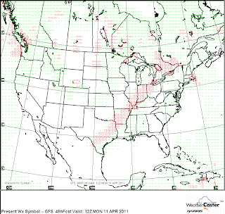
The severe weather threat for Kokomo will again be nocturnal. While Sunday will be very warm, the ingredients to produce severe weather will likely not come together until well after midnight. By then the tornado threat will be lower as a squall line moves across the state ahead of the cold front. Best timing would be 3 to 5 AM.
It is important to make sure your weather radio is working at all times but especially for the overnight events. I highlighted this a few days ago on the Facebook page for Kokomo-Weather but want to let you know the NWS transmitter which serves Howard County has been problematic recently. It normally transmits with 1000 watts of power. However various issues has cause it to fail over to a low power option with the 100 watts. Weather radios not receiving a good signal will not trigger from the alert tones. I urge you to check the location of your weather radio and position it for the best reception possible.
Here are a couple of maps showing the Monday squall line.
Please note the big outbreak potential mentioned earlier in the week is now more focused to the eastern edge of Iowa, north of I-80 in Illinois and the southern half of Wisconsin. Those areas could see a significant outbreak tomorrow and a High Risk area from the SPC will likely be issued for Sunday. Chicago looks to also be in line for a severe threat from the system.


No comments:
Post a Comment